Click HERE to return to all rocks.
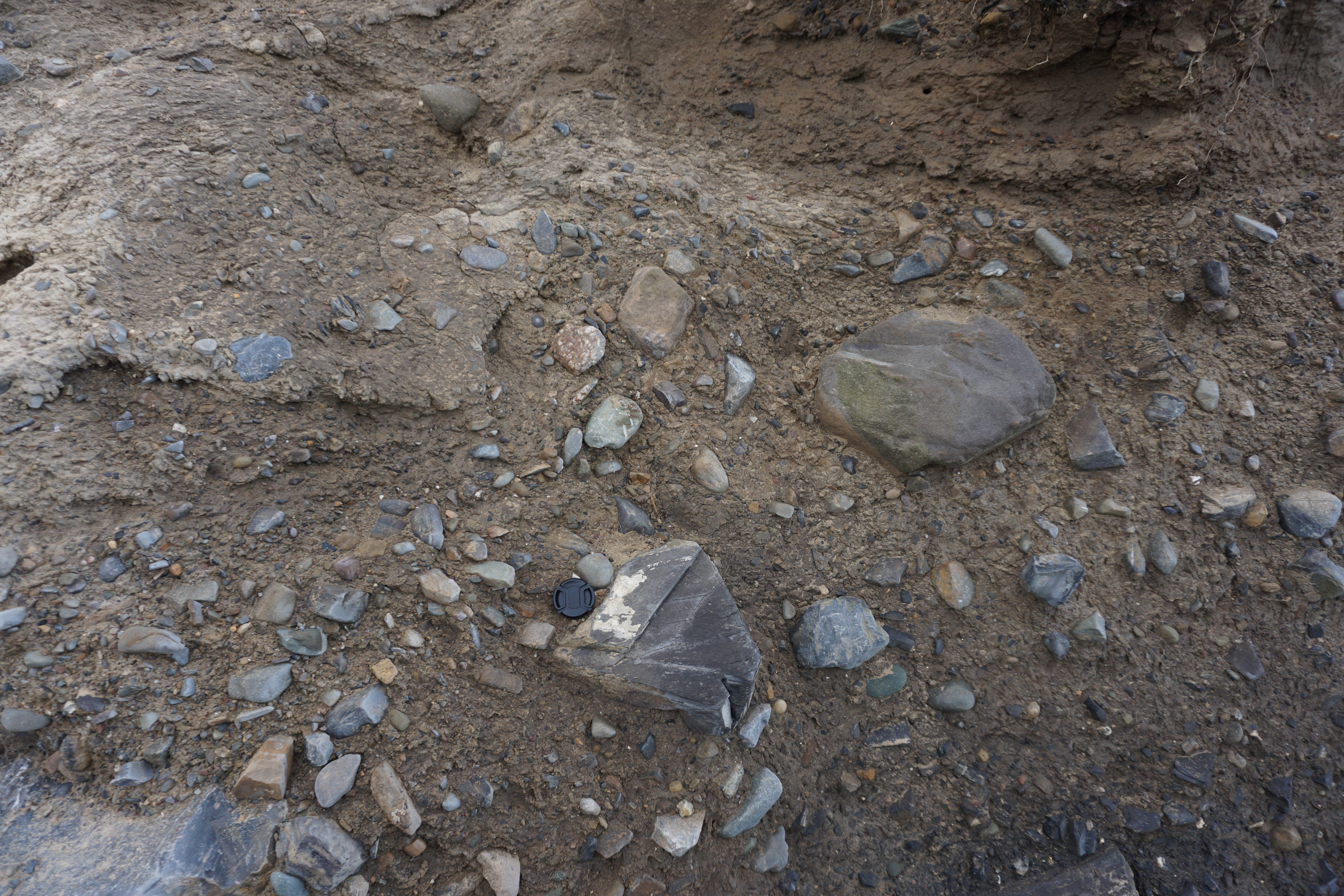
Photo of glacial till from Loughshinny, Dublin County, Leinster, Ireland. Lens cap (5 cm diameter) for scale. While this photo is from Ireland, not the Twin Cities, it accurately shows the range of grain sizes found in a standard glacial till. Image credit: Charlie Smith, https://www.mindat.org/photo-888100.html 🗗
Glacial till is a mix of clay, silt, sand, gravel, and boulders that is deposited by a glacier as it moves across a landscape. In the Twin Cities, the glacial till ranges in thickness up to about 100 feet thick. The color and types of rocks present in a given glacial till can help explain where the glacier had been traveling from.
In Minnesota, the maximum extent of the Laurentide Ice Sheet occurred about 14,000 years ago, during the Ice Age (Pleistocene Epoch). The Laurentide Ice Sheet is the name of the ice sheet that covered much of the northern North American continent during the Pleistocene.
Glacial till is unsorted, containing a wide variety of grain sizes. As glaciers move across bedrock, these carried rocks can scrape across the surface of the bedrock, creating "striations". These can be seen in the basalt along the north shore of Lake Superior, but not in the Twin Cities.
Large glacial erratics (boulders dropped in place by glaciers) are often used as decor pieces.
https://cse.umn.edu/mgs/glacial-geology🗗
https://fmr.org/geology-and-natural-history-mississippi-river-gorge🗗